C
Originally published by Capital Newstop
May 3, 2026
2h ago
Government Maps 59 Flood-Prone Areas in Tana River as Flood Risk Escalates Nationwide
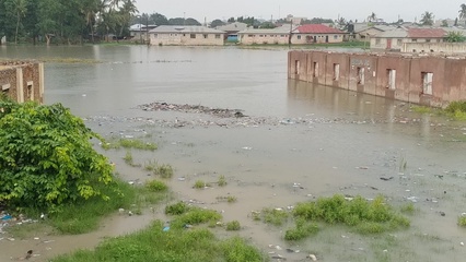
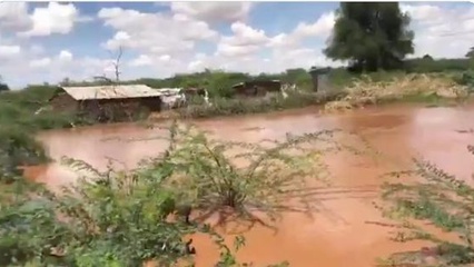
NAIROBI, Kenya, May 3– The Ministry of Interior and National Administration (MINA) has identified 59 flood-prone areas across Tana River County as heavy - Kenya breaking news | Kenya news today | Capitalfm.co.ke..
✨ Key Highlights
Kenya's Ministry of Interior and National Administration (MINA) has identified 59 flood-prone areas in Tana River County as rising river levels and nationwide flooding escalate.
- As of May 2, 2026, 18 fatalities have been recorded nationwide due to flooding.
- The Tana Delta Sub-county accounts for the highest number of high-risk zones at 32 areas.
- The government is coordinating with multi-agency teams and urging residents in vulnerable areas to remain on high alert and evacuate when instructed.
Continue Reading
Read the complete article from Capital News
Advertisement
Related News


Advertisement